|
News: Tropical Cyclone Heidi
|
 |
|
Tropical Cyclone Heidi
CloudSat (CS) completed an overpass of Tropical Cyclone (TC) Heidi (off the NW coast of Australia) on January 11, 2012 at 0600 UTC. TC Heidi contained estimated sustained winds of ~45 knots at the time of the CS overpass as the storm moved southward.
The descending CS overpass through the storm (traversing A -> B) reveals radar attenuation (lack of signal) through the heaviest rain bands of the system. CS passed justed east of the storm center. CS reveals the broader band of heavier precipitation with a smaller band of precipitation moving onshore. Heidi continued to strengthen throughout the day on January 11 into a Category 2 cyclone and made landfall just east of Port Hedland in the early hours of January 12.
Note on radar and satellite imagery: CloudSat imagery and MODIS imagery are ~45 minutes apart (MODIS overpass 45 minutes ahead of CS). NOAA-18 imagery and the CloudSat overpass are ~27 minutes apart.
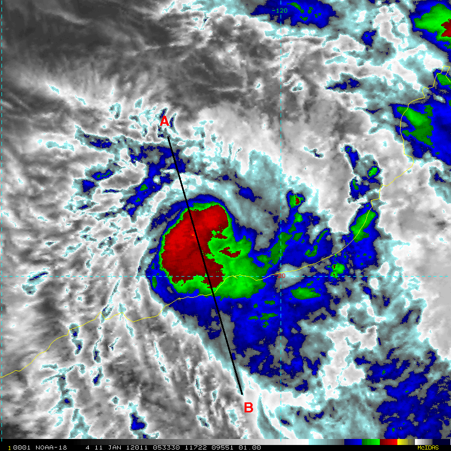
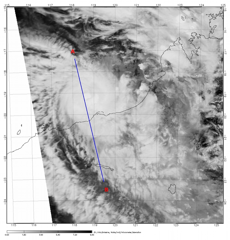
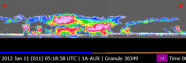
Image sources:
NOAA-18 imagery courtesy of the Regional and Mesoscale Meteorology Branch (RAMMB) at CIRA.
MODIS imagery courtesy of NASA.
CloudSat imagery courtesy of the CS DPC.
Last updated: January 23, 2012 by Natalie D. Tourville
|


