|
News: Tc Bingiza
|
 |
|
Tropical Cyclone Bingiza
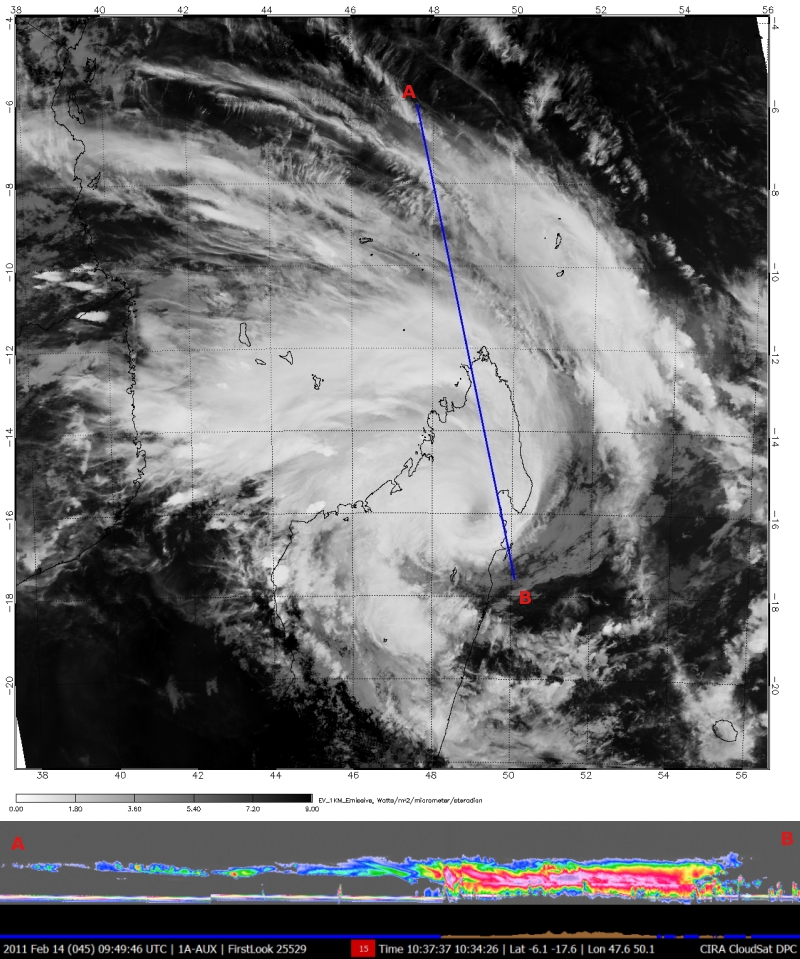
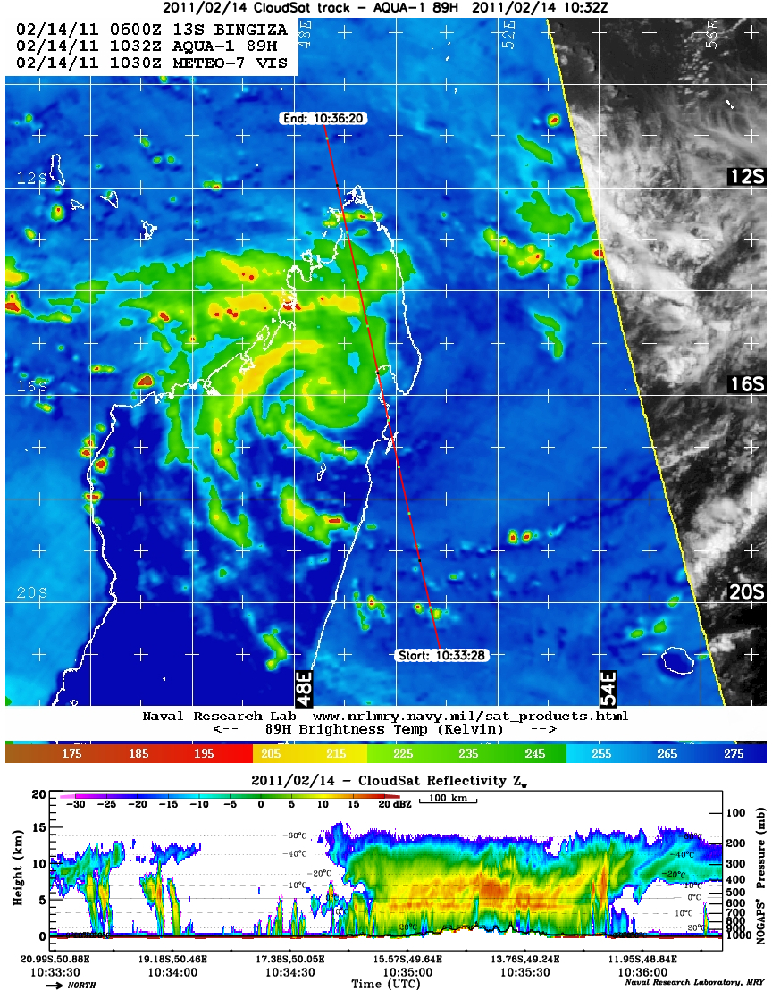
CloudSat overpassed Tropical Cyclone Bingiza located in the southwest Indian Ocean as the storm made landfall over Madagascar on February 14, 2011 at 1035 UTC. Winds are estimated at 75 knots (86 mph) making the storm a category 1. Before landfall, TC Bingiza was a category 3 (intense tropical cyclone) storm with winds of 100 knots (115 mph).
CloudSat captures the storm with most of the deep convection confined over Madagascar. After landfall, the storm intensity decreased due to the depletion of moisture and heat from the ocean. CloudSat passed just to the east of the center of circulation (NRL AMSR-E imagery). Most of the deep convection is limited well below 10 km in height with heavy rain evident over a wide area across the island. The CloudSat cross section depicts land as brown and ocean as blue towards the bottom of the image. The cirrus canopy extends hundreds of miles away from the center of convection over Madagascar. As the center of circulation moves over Madgascar, the intense thunderstorms towards the center weaken and collapse as storm starts to fill in and weaken. MODIS imagery captures the weaken center circulation moving over the island (darker grey clouds).
The heavy rains over Madagascar have left as many as 48,000 people homeless and caused hundred's of millions of dollars in damage to crops. The start of season in the southern Indian Ocean has gotten off to slow start - this is only the second named storm in the area.
|


