|
News: Brazil Thunderstorm
|
 |
|
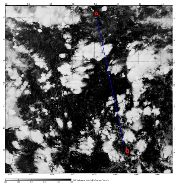
Thunderstorms over central Brazil
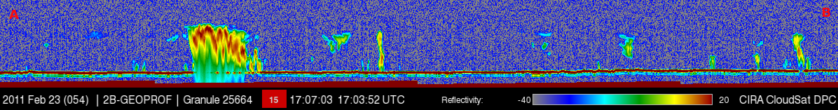
CloudSat captures a developing thunderstorm over central Brazil on February 23, 2011 (1700 UTC). Thunderstorm development is typical over the amazon during this time of year, its summer for southern hemisphere which runs from December through February.
The CloudSat signal is fairly attenuated (loss of signal) due the heavy rainfall formation in this particular cell as warm, very buoyant air ascends rapidly through the system. This explosive development results from just enough moisture in the air, solar energy warming the surface and atmospheric instability. The buoyant air condenses releasing latent heat fueling further cloud development. Strong updrafts dominate the flow pattern and the cloud grows vertically. This stage of development for a thunderstorm is called the cumulus or developing stage, this cloud is most likely a towering cumulus (TCU) or already a cumulonimbus (CB). The CloudSat vertical slice through part of the storm reveals the bubbly cloud tops from strong updrafts and heavy precipitation forming.
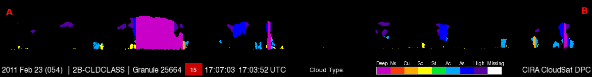
The CloudSat cloud classification product classifies this cloud as deep convective consistent with thunderstorm type cloud groups.
Created and edited by Natalie D. Tourville, March 2, 2011.
|


