|
News: Typhoon Soulik
|
 |
|
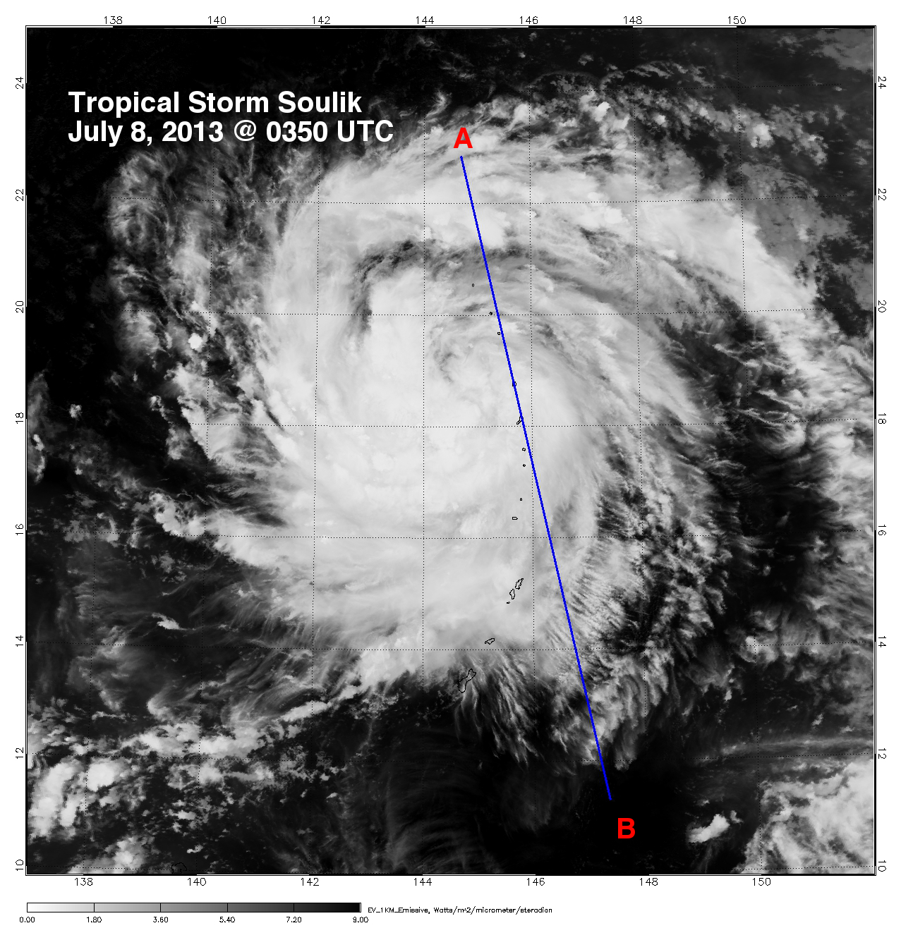
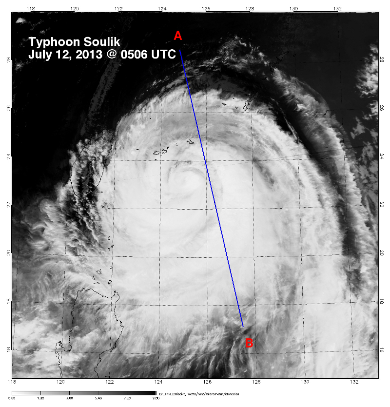
Typhoon Soulik
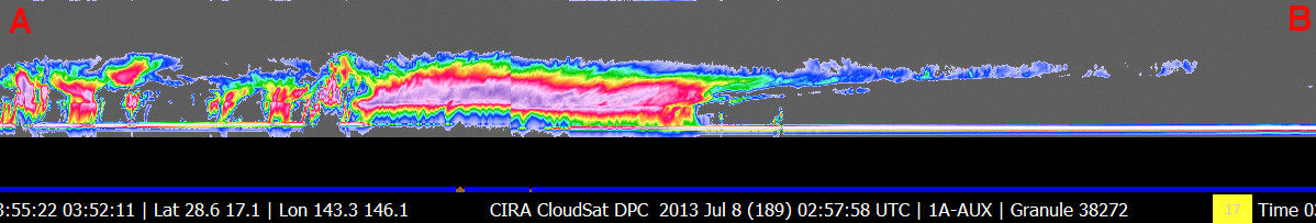
CloudSat overpassed Typhoon Soulik in the West Pacific on July 8 and 12, 2013 at 0350 UTC and 0506 UTC, respectively. Tropical Storm Soulik contained maximum strength winds of 43 knots and minimum pressure of 990mb on July 8th, on July 12th Typhoon Soulik contained maximum strength winds of 90 knots and minimum pressure of 956mb.
The Moderate Resolution Imaging Spectroradiometer (MODIS) on NASA's Aqua satellite captured the infrared (IR) image taken a few minutes before the CloudSat overpass (the blue line). CloudSat overpassed just to the east of the center of the storm in both overpasses. Heavy precipitation is distinuguished by the attenuation of the radar (lack of signal) in the lowest 5 km's of the CloudSat swath. A large area of moderate and light precipitation extends hundreds of kilometers south of the center of the storm in the July 12th overpass. The ragged cirrus overlay is evident in the July 12th overpass by the rippled look of the cloud tops.

References:
NASA Earth Observatory, Typhoon Soulik, Retrieved July 12, 2013.
|


