|
News: Typhoon Guchol
|
 |
|
Typhoon Guchol
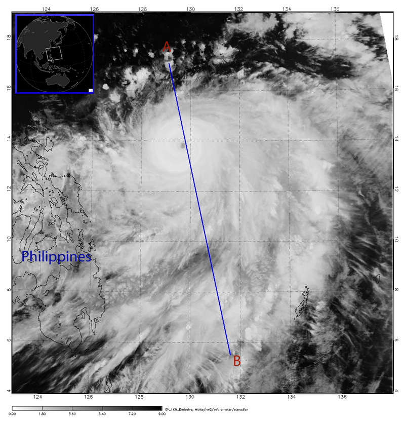
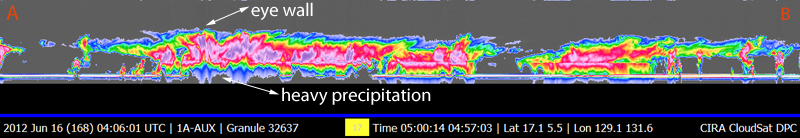
CloudSat overpassed Typhoon Guchol in the West Pacific on June 16, 2012 @ 0500 UTC. Typhoon Guchol, just east of the Philippines, contained sustained winds of 120 knots (104 mph) and minimum pressure of 948 mb.
The Moderate Resolution Imaging Spectroradiometer (MODIS) on NASA's Aqua satellite captured the infrared (IR) image taken a few minutes before the CloudSat overpass (the blue line). CloudSat overpassed just to the east of the center of the storm through the eye wall and. Heavy precipitation is distinuguished by the attenuation of the radar (lack of signal) in the lowest 5 km's of the CloudSat swath. A large area of moderate and light precipitation extends hundreds of kilometers south of the center of the storm. Individual cumulonimbus cells are evident underneath the anvil shield (towards the B label).
Typhoon Guchol strengthened into a Super Typhoon shortly after this image was captured and continued north and westward towards Japan. Guchol brought heavy rains and high winds to parts of Japan on June 19 and 20, 2012 as a tropical storm.
References:
NASA Earth Observatory, Typhoon Guchol, Retrieved June 22, 2012.
|


