|
News: Tropical Storm Beryl
|
 |
|
Tropical Storm Beryl
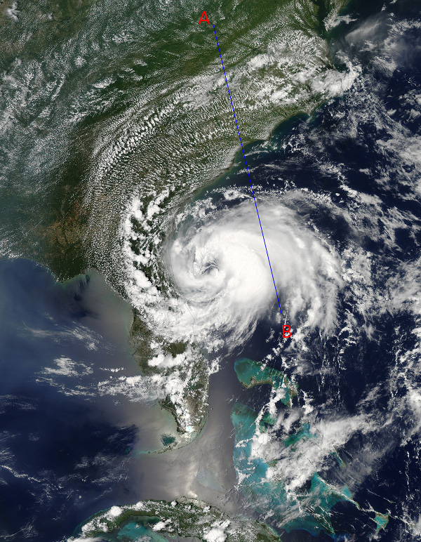
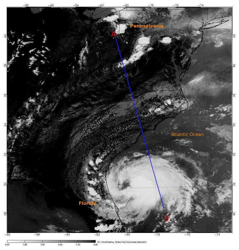
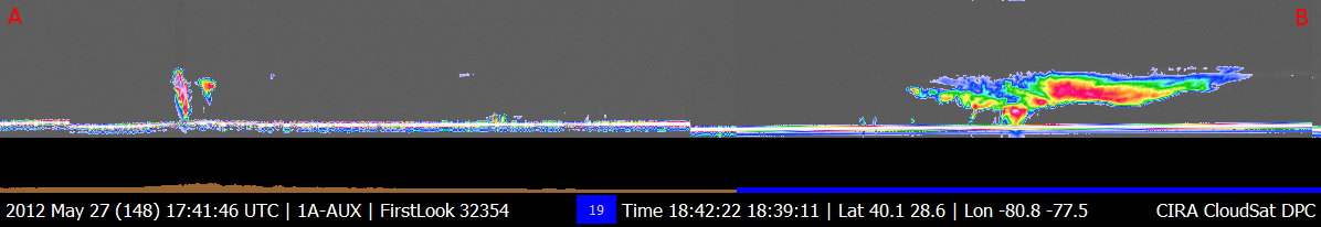
CloudSat overpassed Tropical Storm Beryl, just off the coast of Florida on May 27, 2012 at 1840 UTC (1440 EDT). The storm was slowly intensifying and moving westward with maximum sustained winds of 65 mph (100 km/h). CloudSat (blue line) intersects Beryl about 200 km east of the storm center. MODIS (aboard the A-TRAIN satellite AQUA) and the CloudSat cloud profiling radar (CPR) track are shown in Figures 1 and 2. The MODIS imagery in Figure 1 is a natural-color image and Figure 2 is the MODIS Infrared (IR) imagery both taken at 1430 EDT. The CloudSat cross section is shown below the MODIS imagery, A and B designate the starting and ending points of the overpass.
Beryl has slightly intensifyed during the past 6 hours as the system moves westward towards the coast. It is starting to take on more features typical of a tropical cyclone rather than a subtropical low, as the system was first classified. An eye is starting to form and convection increases around the center of the storm, most notably on the east side of the storm by the bright white clouds tops. The CloudSat overpass reveals the mid and upper level clouds associated with the outer bands and cirrus anvil extending outward from the system. Maximum cloud top heights are around 12-13 KM along this CloudSat intersection of the system.
The MODIS natural color imagery picks up the small cumulus and stratus cells (bright white dots) over portions of North Carolina and Virginia that the CloudSat CPR for the most part does not detect. Surface clutter in the lowest 1KM of the atmosphere containments observations at these low levels (the first 3-4 levels of the CloudSat profile). CloudSat observes some of the taller cumulus cells (around 2-3 KM in vertical height) but misses anything less than a 1 KM in height.
| Figure 1. MODIS natural color | Figure 2. MODIS
|  |
 |
|
GOES satellite imagery and animation with the CloudSat cross section is shown below for Beryl. The animation depicts the early stages of Beryl forming over the Atlantic Ocean.
References:
Earth Observatory. Retrieved on May 30, 2012, Tropical Storm Beryl.
National Hurricane Center, Retrieved on May 31, 2012, Beryl Advisory Archive.
CloudSat Data Processing Center, Retrieved on May 30, 2012, CloudSat DPC.
MODIS Imagery, Retrieved on May 30, 2012, FTP Site.
|


