|
News: Tropical Cyclone Imelda
|
 |
|
Tropical Cyclone Imelda
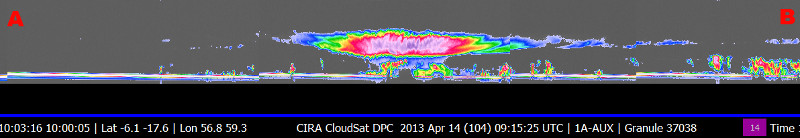
CloudSat overpassed Tropical Cyclone Imelda churning in the southern Indian Ocean on April 14, 2013 at 1000 UTC. TC Imelda contained maximum sustained winds around 65 knots (120 kilometers per hour) at the time of the overpass (a category 1 tropical strength system). CloudSat passed just to the west of the storm center (about 20 km outside of the eye center) through an area of deep eyewall convection. This area of deep convection contains large amounts of water/ice content (the deep reds and pink colors show higher reflectivity -> larger sized water/ice droplets). The CloudSat overpass reveals the sloped shaped of the eyewall. Small cumulus/stractocumulus type cells are evident in the lower layers (near the surface of the water, below 5-6 km). CloudSat captures the upper portion of the curved eyewall with the pink and red reflectvities about 7 km. The anvil extends outward in boths directions with cloud top heights reaching 15-16 km in this overpass. This exceptional overpass reveals the immense capabilities of CloudSat's CPR - the ability to penetrate to the surface and detect various cloud layers, eyewall structure and slope in great detail. Since CloudSat did not overpass any heavy precipitation cores the inner vertical details of the TC core are relatively unattenuated by the radar signal.
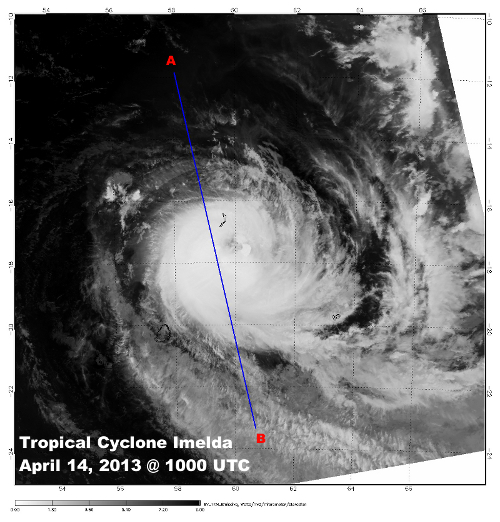
The Moderate Resolution Imaging Spectroradiometer (MODIS) on NASA's Aqua satellite captured the infrared (IR) (Figure 1) image taken a few minutes before the CloudSat overpass (Figure 2) denoted by the blue line A->B.
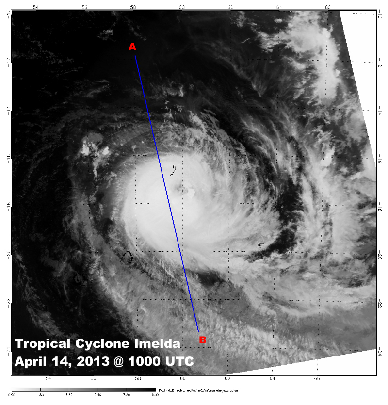 Figure 1. MODIS IR imagery with CloudSat track (blue). (courtesy NOAA LAADS Web) Figure 1. MODIS IR imagery with CloudSat track (blue). (courtesy NOAA LAADS Web)
 Figure 2. CloudSat overpass track (courtesy CloudSat Data Processing Center) Figure 2. CloudSat overpass track (courtesy CloudSat Data Processing Center)
 Figure 3. Enhanced 1KM MODIS IR Imagery (courtesy RAMMB) Figure 3. Enhanced 1KM MODIS IR Imagery (courtesy RAMMB)
References:
JTWC - http://www.usno.navy.mil/JTWC/, Retrieved April 15, 2013.
MODIS imagery, LAADS Web, Retrieved April 16, 2013.
Earth Observatory - https://earthobservatory.nasa.gov/NaturalHazards/view.php?id=80918, Retrieved April 16, 2013.
Regional and Mesoscale Meteorology Branch (RAMMB) - Tropical Cyclone Imelda
Last updated: April 16, 2013 by Natalie D. Tourville
|