|
News: January East Coast Snow
|
 |
|
January East Coast Snow - January 2016
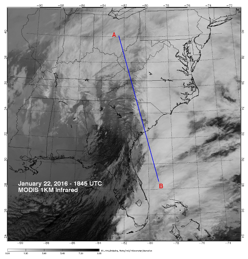
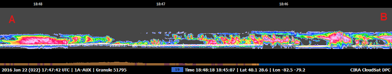
CloudSat overpassed a developing nor'easter on January 22, 2016 @ 1845 UTC. This system brought heavy snow to the Ohio valley and Northeast US from January 22-24, 2016.
The CloudSat overpass details areas of precipitation from Ohio through South Carolina and reveals the strong mid-level flow from southeast by the leftward tilted cloud tops. A thin cirrus layer (blue and green areas) atop the convection cells is evident over Atlantic Ocean and South Carolina cloud area. Further north an area of moderate snowfall is developing (deep red and pink areas).
The Moderate Resolution Imaging Spectroradiometer (MODIS) on NASA's Aqua satellite captured the infrared (IR) (Figure 1) image taken a few minutes before the CloudSat overpass (Figure 2) denoted by the blue line A->B).
 Figure 1. MODIS IR imagery (courtesy NOAA LAADS Web) with CloudSat track (blue). Figure 1. MODIS IR imagery (courtesy NOAA LAADS Web) with CloudSat track (blue).
 Figure 2. CloudSat overpass track (courtesy CloudSat Data Processing Center). Figure 2. CloudSat overpass track (courtesy CloudSat Data Processing Center).
References:
MODIS imagery, LAADS Web, Retrieved January 30, 2016.
CloudSat imagery, CloudSat DPC, Retrieved January 30, 2016.
Weatherunderground, Winter Storm Jonas: Fourth Strongest Nor'easter since 1950, Retrieved April 24, 2016.
Last updated: April 24, 2016 by Natalie D. Tourville
|