CloudSat completed an eye overpass of Hurricane Nicole on October 12, 2016 @ 1755Z as the storm was moving towards Bermuda. The system contained sustained winds of 95 knots with a minimum pressure of 962 mb. CloudSat viewed the system just as it was going through a period of intensification (from 85 knots to 105 knots during a 12 hour period).
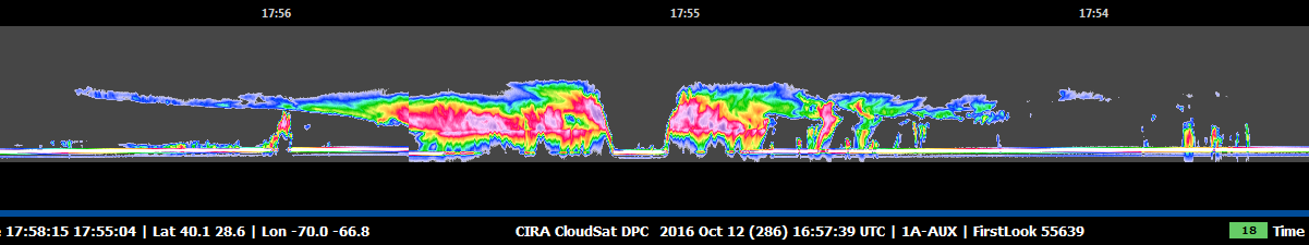
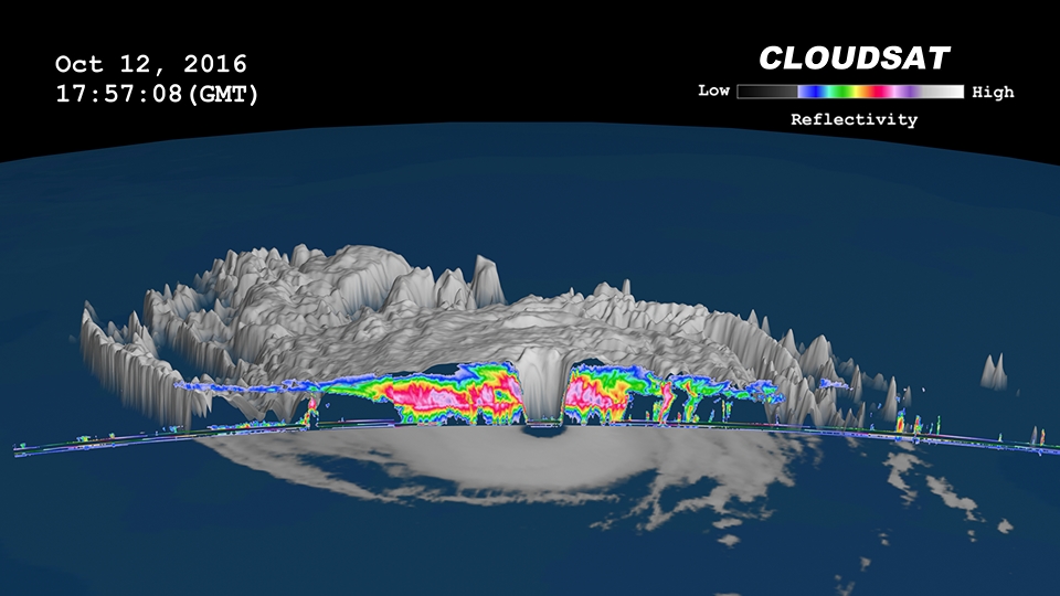
CloudSat overpassed directly through the eye of the storm (Figure 1). The CloudSat overpass (Figure 2) reveals the curved outward appearance from the surface to cloud top height of the eyewall, cirrus bands extending outwards and heavy precipitation in the rainbands surrounding the eyewall.
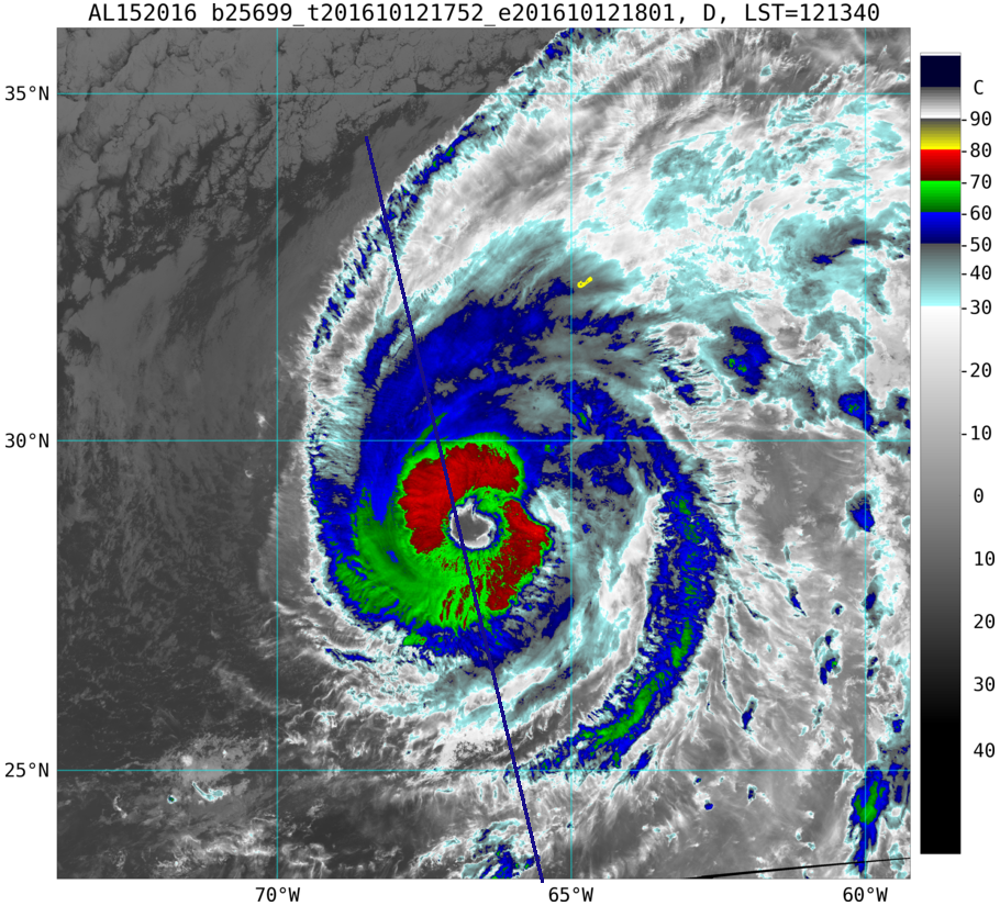
The Visible Infrared Imaging Radiometer Suite (VIIRS) overpassed CloudSat during the same time period (Figure 5). The Enhanced Infrared Imagery (11 μm brightness temperature) depicts the cloud tops (less than -70 C) at cloud top height.
CloudSat intersections directly the storm center occur infrequently but when they do happen they provide an exceptional and one of kind view of the internal structure of tropical cyclones.
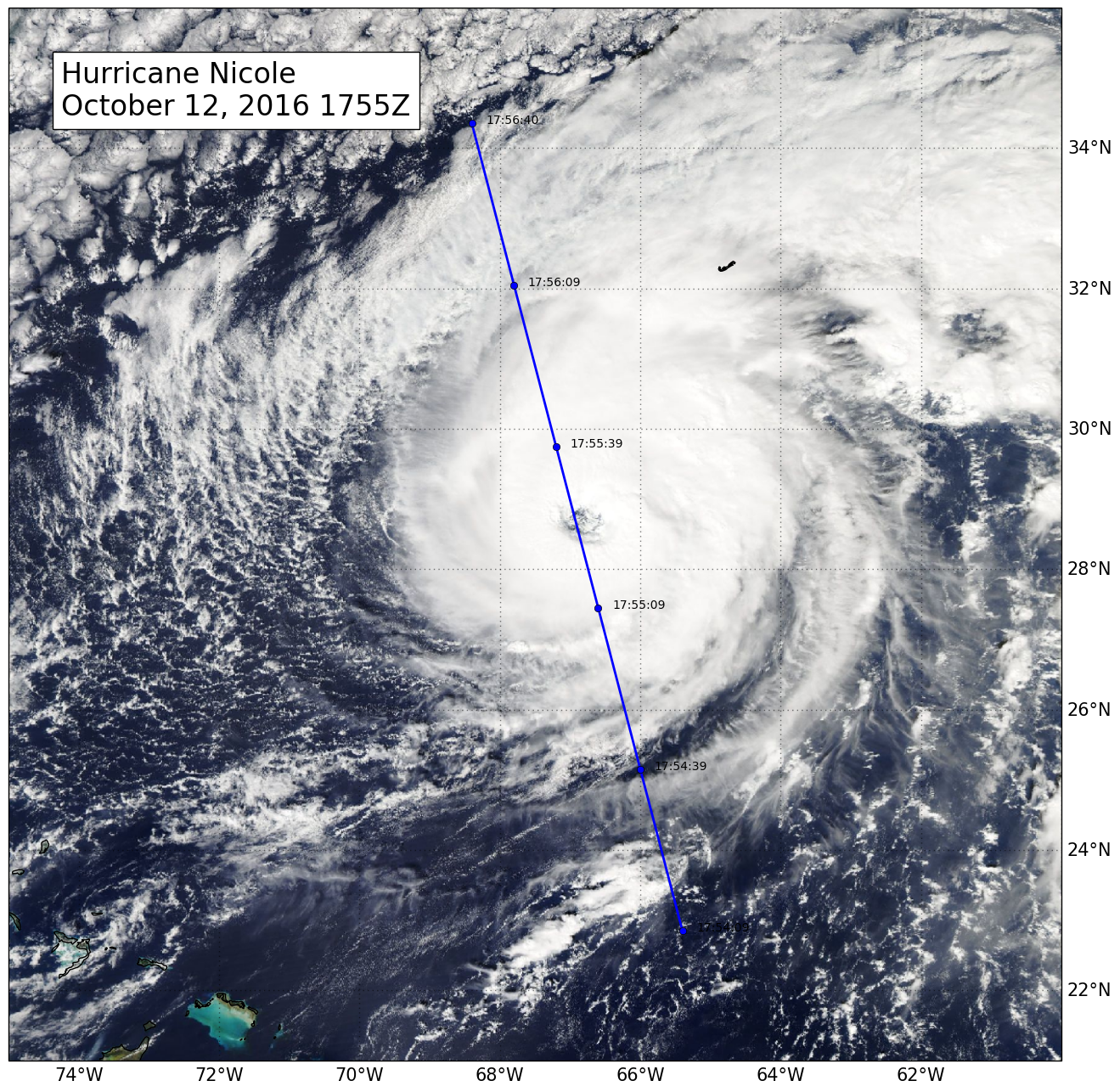
The Moderate Resolution Imaging Spectroradiometer (MODIS) on NASA's Aqua satellite captured the infrared (IR) image taken a few minutes before the CloudSat overpass (the blue line on Figure 1). Figure 2 depicts the CloudSat 1B-CPR imagery of the overpass. Figure 3 is a time lapsed animation combining GOES imagery and the CloudSat overpass. Figure 4 merges GOES and CloudSat imagery into a 2D image. Figure 5 is the VIIRS enhanced infrared imagery with the CloudSat track (blue line) courtesy of CIRA RAMMB.
Figure 1. MODIS imagery with CloudSat track and UTC time (blue line) of Hurricane Nicole.
Figure 2. CloudSat 1B-CPR imagery of Hurricane Nicole.