|
News: Typhoon Utor
|
 |
|
Typhoon Utor
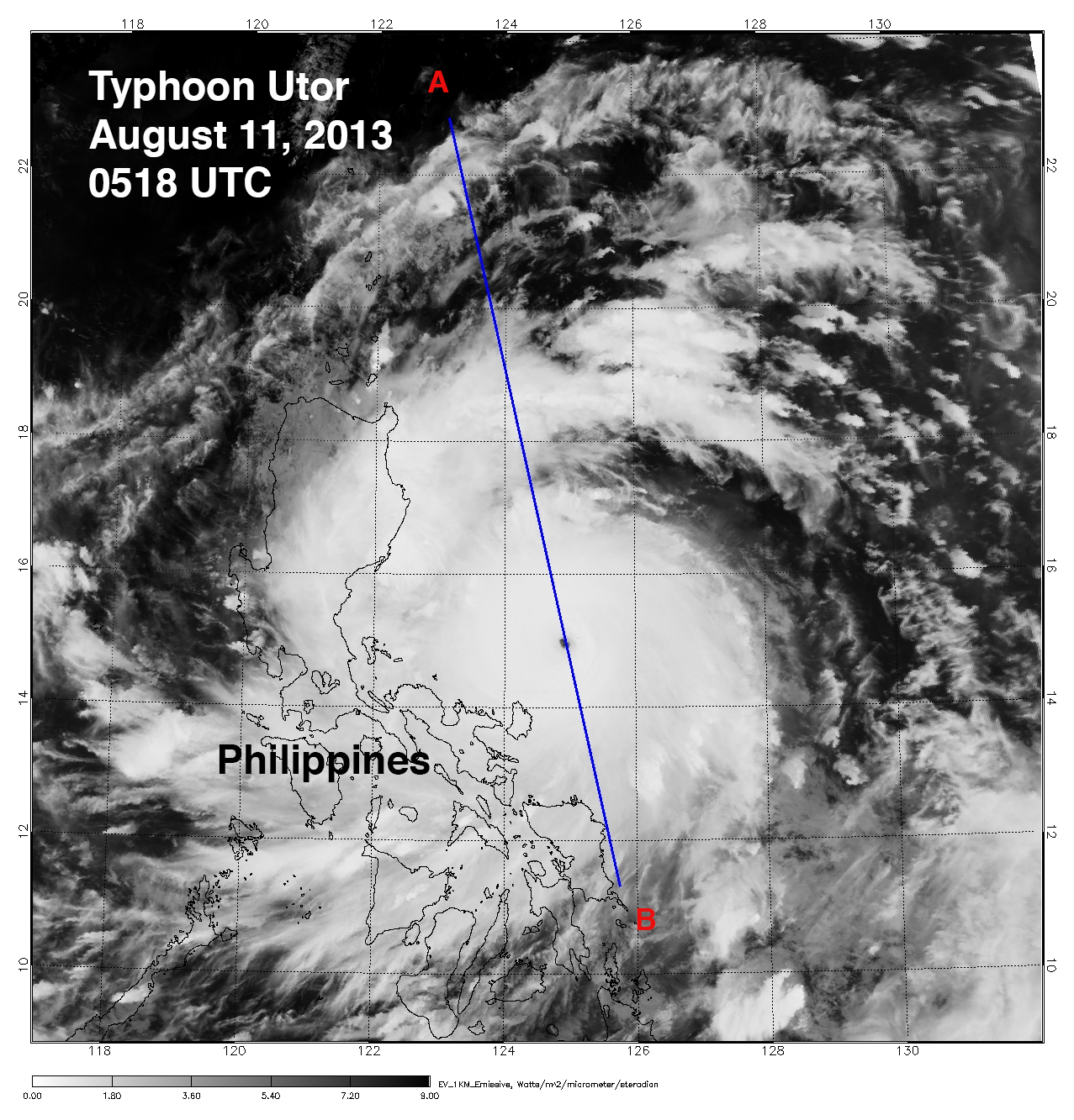
CloudSat overpassed Typhoon Utor in the West Pacific on August 11, 2013 at 0518 UTC, this storm contained estimated maximum strength winds of 115 knots (132 mph) and minimum pressure of 937mb.
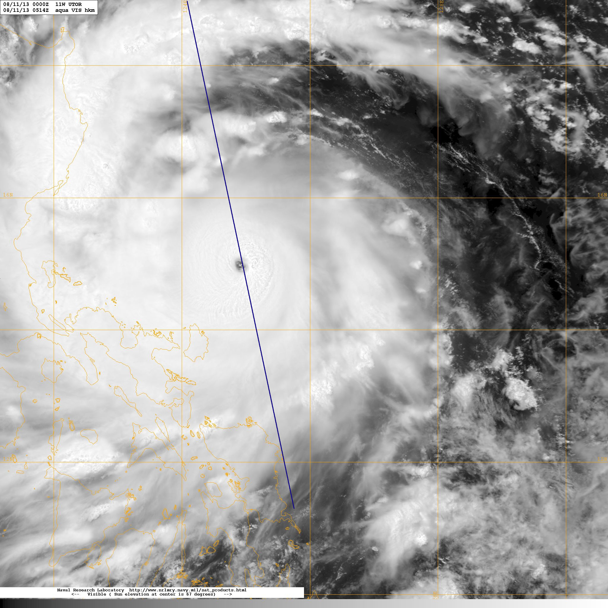
The Moderate Resolution Imaging Spectroradiometer (MODIS) on NASA's Aqua satellite captured the infrared (IR) image taken a few minutes before the CloudSat overpass (the blue line A-> B on Figures 1, 2 and 3). CloudSat overpassed about 10km to the east of the center of the storm revealing the structure of the eye and eye wall. This is one a handful of cases where CloudSat has directly intersected the eye of a storm of this intensity and size. The strength of Utor's at this time is equivalent to category 4 strength hurricane.
This overpass reveals many unique features of a well defined and intense Typhoon (tropical cyclone) - outward sloping eye and eyewall, rainband areas, moats and areas of high reflectivity (greater than 30dBZ). Heavy precipitation is distinuguished by the attenuation of the radar (lack of signal) in the lowest 5 km's (up to almost 10 km's in the eyewall area) of the CloudSat swath. The CloudSat overpasses reveals large amounts of liquid and ice water spread throughout the storm and also distinguishes rainbands areas separated by moats (cloud free areas) beneath the cirrus canopy.
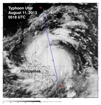
Figure 1. MODIS imagery of Typhoon Utor.
| 
Figure 2. High resolution MODIS imagery (courtesy NRL).
| 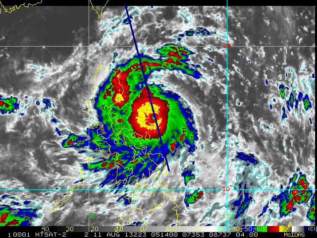
Figure 3. 4km Remapped Color Enhanced Infrared Imagery (courtesy RAMMB).
| 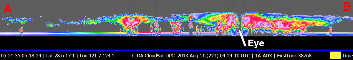
Figure 4. CloudSat overpass.
|
References:
MODIS imagery, LAADS Web, Retrieved August 16, 2013.
4km Remapped Color Enhanced Infrared Imagery, Hurricane Henriette, Retrieved August 16, 2013.
CloudSat Data Processing Center, Retrieved August 16, 2013.
NRL Tropical Cyclone Page, Typhoon Utor, Retrieved August 16, 2013.
Last Updated: Natalie D. Tourville, August 20, 2013.
|