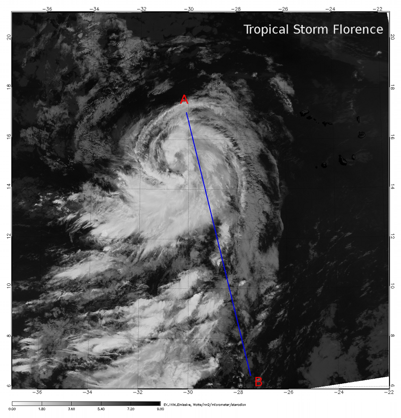
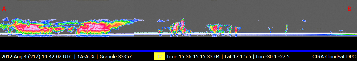
CloudSat overpassed Tropical Storm Florence in the Atlantic Ocean on August 4, 2012 at 1533 UTC (1133 EDT). CloudSat overpassed just to the east of the storm center, intersecting the eastern portion of the storm system.
The Moderate Resolution Imaging Spectroradiometer (MODIS) on NASA's Aqua satellite captured the infrared (IR) (Figure 1) image taken a few minutes before the CloudSat overpass (Figure 2) denote by the blue line A->B).
CloudSat reveals two area of light to moderate precipitation in the bands to the northeast and southeast. Cloud top heights are esimated around 11-12 km containing a mixture of cumulonimbus, altocumulus and cirrus. Estimated winds in the system were around 40 knots at the time of the CloudSat and MODIS overpass.
Florence is starting to become more symmetrical but areas of dust, stable air mass and marginal warm waters allowed Florence to slightly intensify but not reach Hurricane strength. Florence eventually turned northeastward into the open waters of the Atlantic.
An animation containing GOES satellite imagery with CloudSat imagery overlaid is shown in Figure 3 (courtesy Shigeru Suzuki of JPL).
Figure 1. MODIS IR imagery (courtesy NOAA LAADS Web).
Figure 2. CloudSat overpass track (courtesy CloudSat Data Processing Center).