|
News: Tropical Depression Flossie
|
 |
|
Tropical Depression Flossie
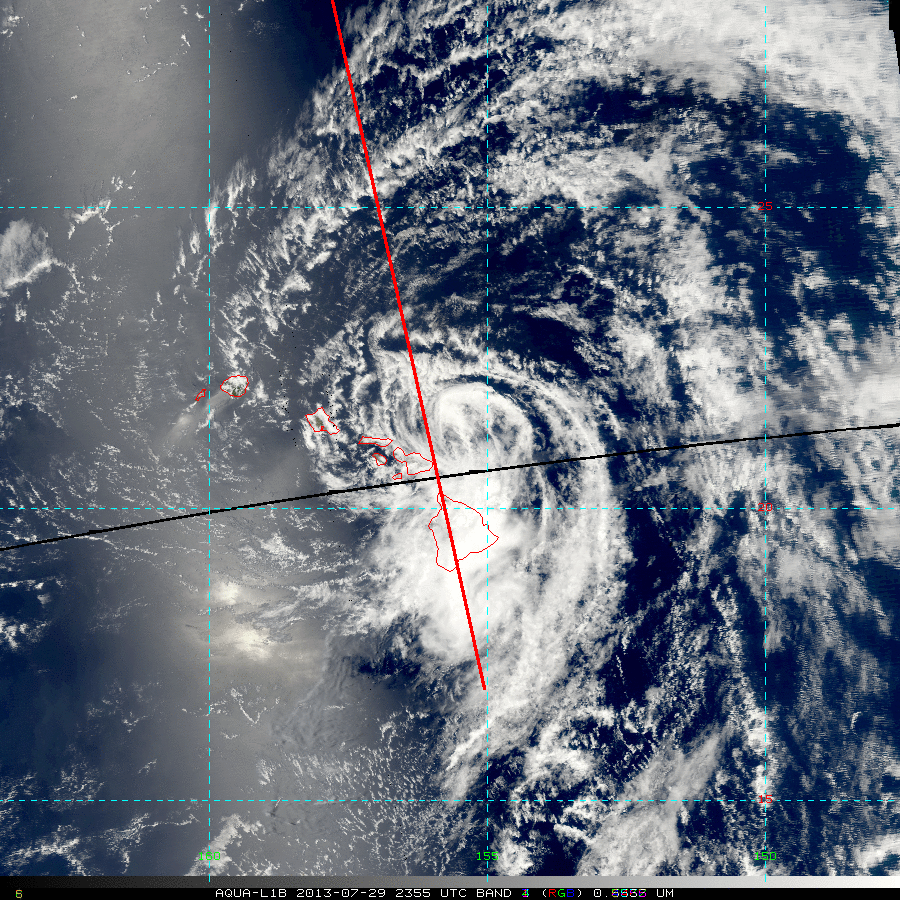
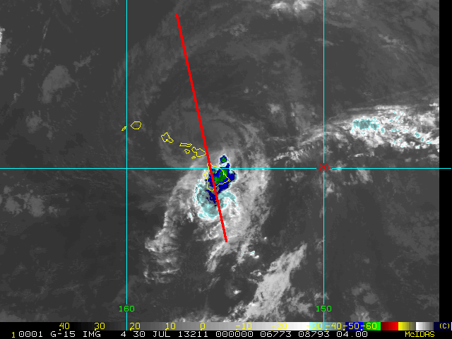
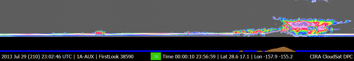
CloudSat overpassed Tropical Depression Flossie at 2356 UTC on July 29th, 2013. Flossie contained estimated winds of 30 knots and was heading westward towards Hawaii at the time of this overpass. CloudSat overpassed just to the outside of the storm center revealing Flossie still contained deep convection and moderate to heavy areas of rainfall. The CloudSat overpass reveals low level cloud types (cumulus and stratocumulus) on the north side of Hawaii and more convective clouds (cumulonimbus) over the southern portion of Hawaii. Large amounts of liquid and ice water (deep reds and pink color) are abundant at mid and lower levels of the storm system. Cloud top heights are estimated at 12-13km with just a small area of cirrus outflow (light blue). The MODIS natural color imagery reveals the low level circulation displaced to the north/northeast of the main area of convection. The 1km IR imagery shows cold cloud top brightness temperatures around -60 C in the deepest area of convection.
Flossie moved over the Hawaiian islands on July 29 and 30th bringing high surf, flash flood watches and strong winds to the islands. Flossie is the first tropical system to intersect the islands since 1992.
| MODIS natural imagery with CloudSat intersect (image courtesy the Regional and Mesoscale Meteorology Branch (RAMMB))
|  |
| 4KM IR imagery with CloudSat intersect (image courtesy the Regional and Mesoscale Meteorology Branch (RAMMB))
|  |
|
GOES satellite imagery and animation with the CloudSat cross section is shown below for TD Flossie.
References:
National Hurricane Center, Retrieved on July 30, 2013, TS Flossie Advisory Archive.
CloudSat Data Processing Center, Retrieved on July 30, 2013, CloudSat DPC.
RAMMB TC Realtime, Retrieved on July 30, 2013, Tropical Depression Flossie.
|


