|
News: Tropical Depression Aletta
|
 |
|
Tropical Depression Aletta
Tropical Storm Aletta, the first tropical system of the Eastern Pacific (EP) season, formed southwest of Mexico on May 11, 2012. The system reached maximum winds of 45 knots on May 16th but quickly lost organization due to unfavorable tropical atmospheric conditions.
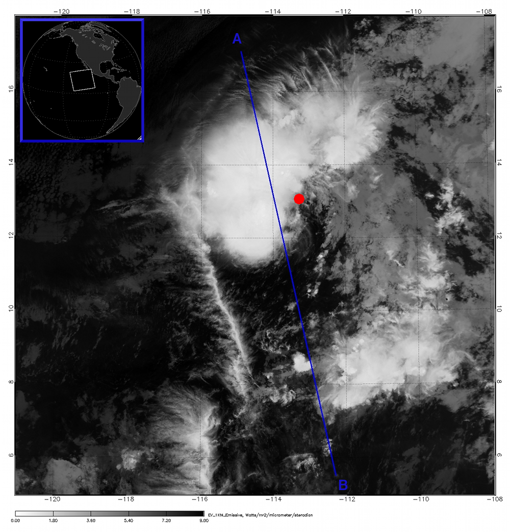
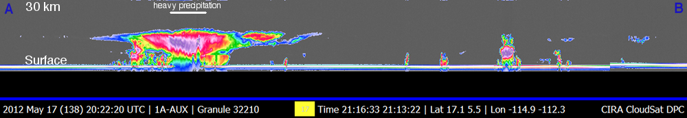
CloudSat overpassed Tropical Depression Aletta on May 17, 2012 at 2115 UTC as the storm continued to diminish in strength. Winds were estimated at 30 knots with a pressure of 1006 mb at the time of this overpass. Wind shear and a low pressure trough moving across the area contributed to the demise of the system. MODIS imagery (aboard the AQUA satellite) overlaid with the CloudSat track (blue line) reveals the main convective core west of the center of the circulation (red dot). This convective core is all that remains of the weakening Aletta. Heavy precipitation is noted by lacked of signal (attenuation) of the CPR (cloud profiling radar). CloudSat's 94GHz radar signal can detect in the range of -40 dBZ to 20 dBZ.
The anvil of the system extends north and south of the system as the convective core reaches the tropopause and spreads outward. Cloud top heights reach 15-16 km, smaller convective cumulus cells can be seen to the north and south of the system underneath the cirrus anvil top. CloudSat observations reveal the vertical distribution of water and layering of clouds not available with other conventional radars.
CloudSat recently celebrated six years since launch (April 28, 2006) and is approaching six years since the radar become operational (June 2, 2006). The satellite recently rejoined the A-TRAIN satellite constellation on May 16, 2012 after a battery anomaly in April 2011 and continues to operate during the daylight hours.
Created and updated by Natalie Tourville (Natalie.Tourville@colostate.edu)
|


