|
News: Queensland Flooding
|
 |
|
Areas in the eastern Australian state of Queensland have experienced some of the worst flooding on record as persistent areas of rain inundate the region. A persistant and strong La Nina has created relatively warmer waters over the northeast coast bringing with it heavy rains.
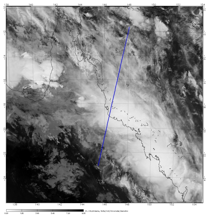
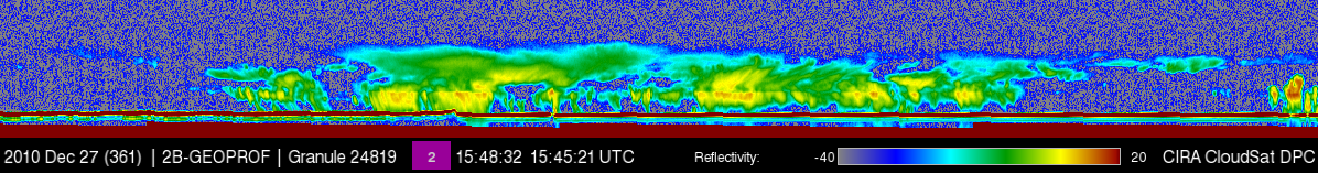
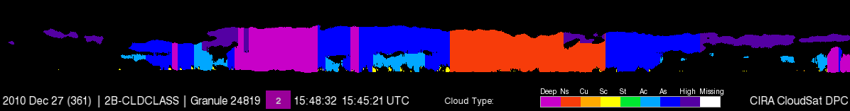
Tropical cyclone Tasha moved over the Queensland on December 25, 2010 and CloudSat overpassed the northern remnants of the storm on December 27, 2010 over Queensland. CloudSat reveals the wide swath of clouds containing a mixture of deep convective, nimbostratus, altostratus and altocumulus cloud types. Light showers are evident from some of heavy convective areas (in brighter yellow and light orange on the radar reflectivity). CloudSat also captures abundant moisture in the mid and upper levels by the wide area of clouds at these levels not reaching the surface to produce rainfall.
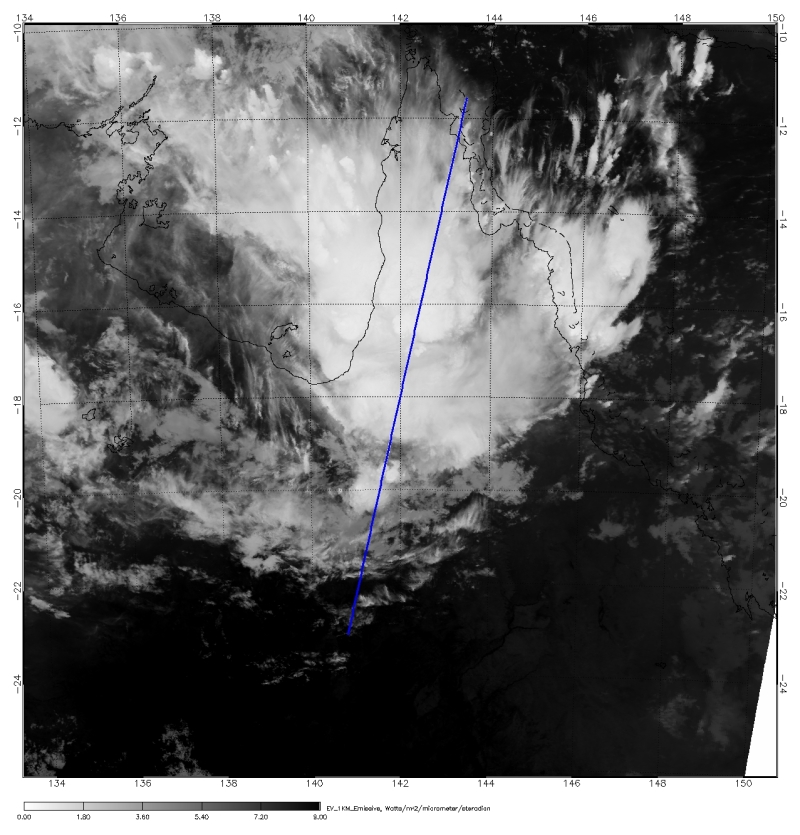
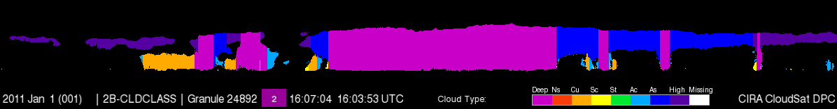
CloudSat also overpassed a deep convective cell on January 1, 2011. Heavy rainfall is evident from the attenuation (loss of radar signal) in some areas. CloudSat identifies these cloud types as deep (indicating cumulonimbus type cells) and cumulus with altostratus and cirrus in the mid and upper levels. Persistant storms (similar to these) bringing heavy rains over the same areas have led to millions of dollars in damages to agriculture, businesses and homes.

Sources:
* Weather Underground, Retrieved January 4, 2011.
* Earth Observatory - Heavy Rain in Queensland, Retrieved January 2, 2011.
|


