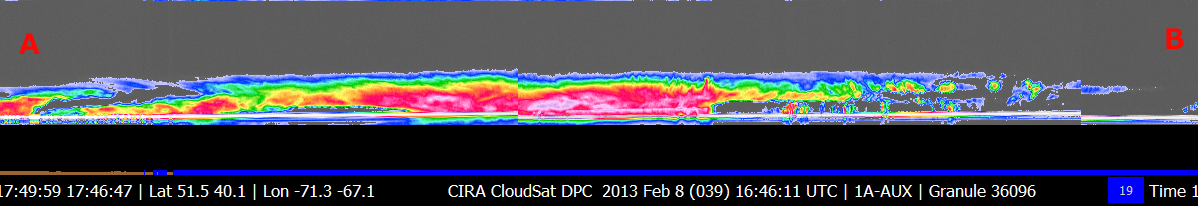
CloudSat overpassed the large storm system pounding the northeastern United States on February 8, 2013 with large amounts of snow. Snowfall rates reached up to 6" per hour in portions of Connecticut with this storm system. Cloud top heights in this particular overpass are around ~12km. A large area of high liquid water content (LWC) is distinguishable from the red and pink color of the CloudSat overpass (Figure 2). Small cumulus and stratus clouds are visible beneath the the thick cirrus canopy extending southeastward over the Atlantic Ocean.
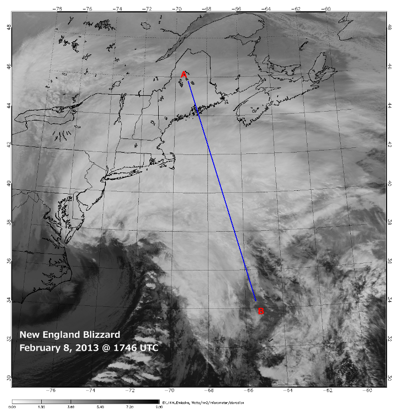
The Moderate Resolution Imaging Spectroradiometer (MODIS) on NASA's Aqua satellite captured the infrared (IR) (Figure 1) image taken a few minutes before the CloudSat overpass (Figure 2) denoted by the blue line A->B.
An animation containing GOES satellite imagery with CloudSat imagery overlaid is shown in Figure 3 (courtesy Shigeru Suzuki of JPL).
Figure 1. MODIS IR imagery (courtesy NOAA LAADS Web).
Figure 2. CloudSat overpass track (courtesy CloudSat Data Processing Center).
Figure 3. New England Storm Animation - Atlantic Ocean, Febraury 8, 2013.
References:
MODIS imagery, LAADS Web, Retrieved February 22, 2013.