|
News: Cloudsat Observes A Polar Low
|
 |
|
Polar Low Observed by CloudSat: The Arctic’s Version of a Tropical Cyclone
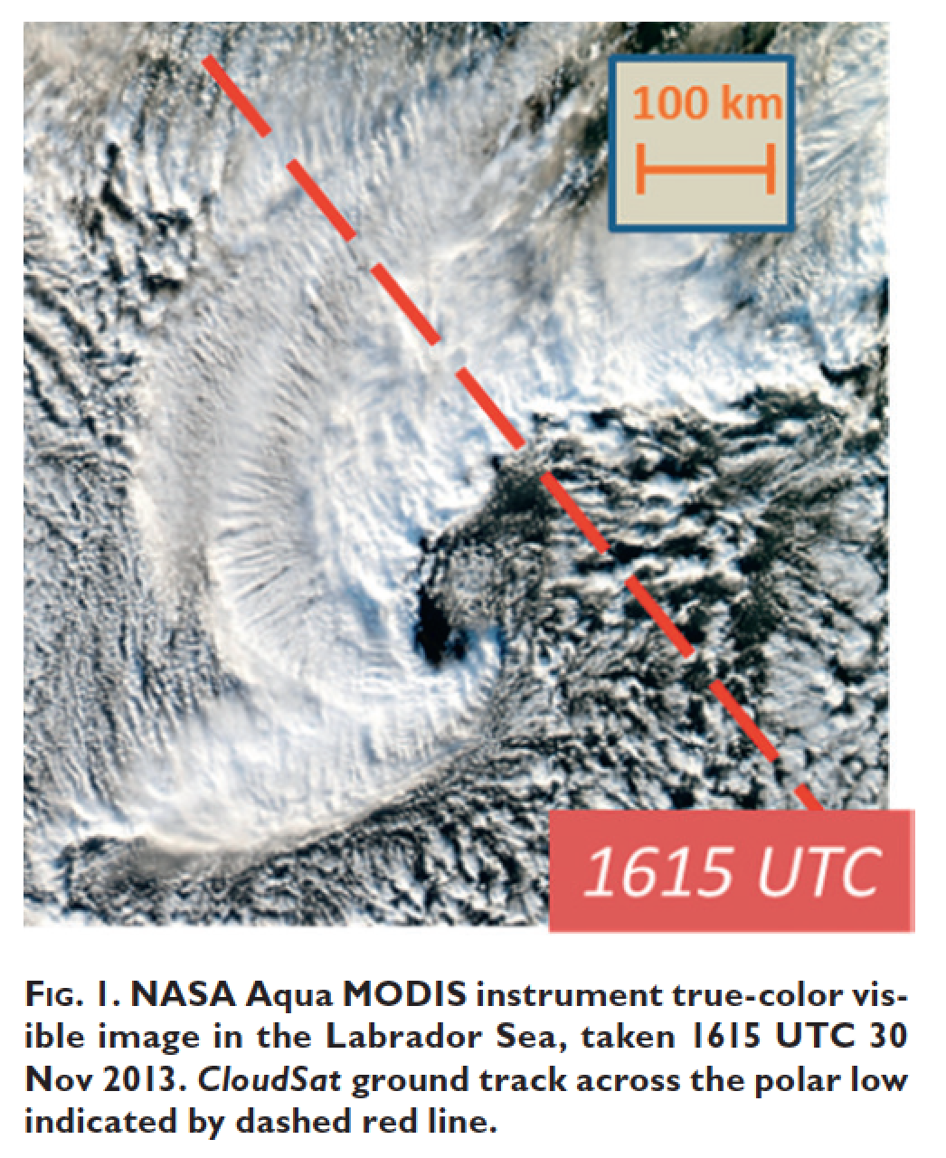
Title: Cloudsat observes a Labrador sea polar low.
DOI: http://dx.doi.org/10.1175/BAMS-D-14-00058.1
Product tags: MODIS-AUX, NI - not identified
When cold polar air moves over warm water, a polar low is created, which is a storm that looks almost like a tropical cyclone, with an eye and everything. Because polar lows are hard to observe, since they’re small, form quickly, and reside in data-lacking oceans where land-based satellites cannot see them, they pose a much greater risk to coastal and maritime operations in the polar seas.
CloudSat provides the ability to study polar lows, and better help scientists learn about how polar lows affect the environment around them, as well as how they behave. Through CloudSat’s lifetime, it is estimated to have passed over around 40 daytime polar lows, which need to now be identified.
To learn more about what CloudSat sees in a polar low and how they are distinguished from regular polar clouds, read the full article here: http://dx.doi.org/10.1175/BAMS-D-14-00058.1
Synopsis Author: Kalina Velev, JPL
|


