|
News: 2010 Atlantic
|
 |
|
Hurricanes Igor, Julia and Karl
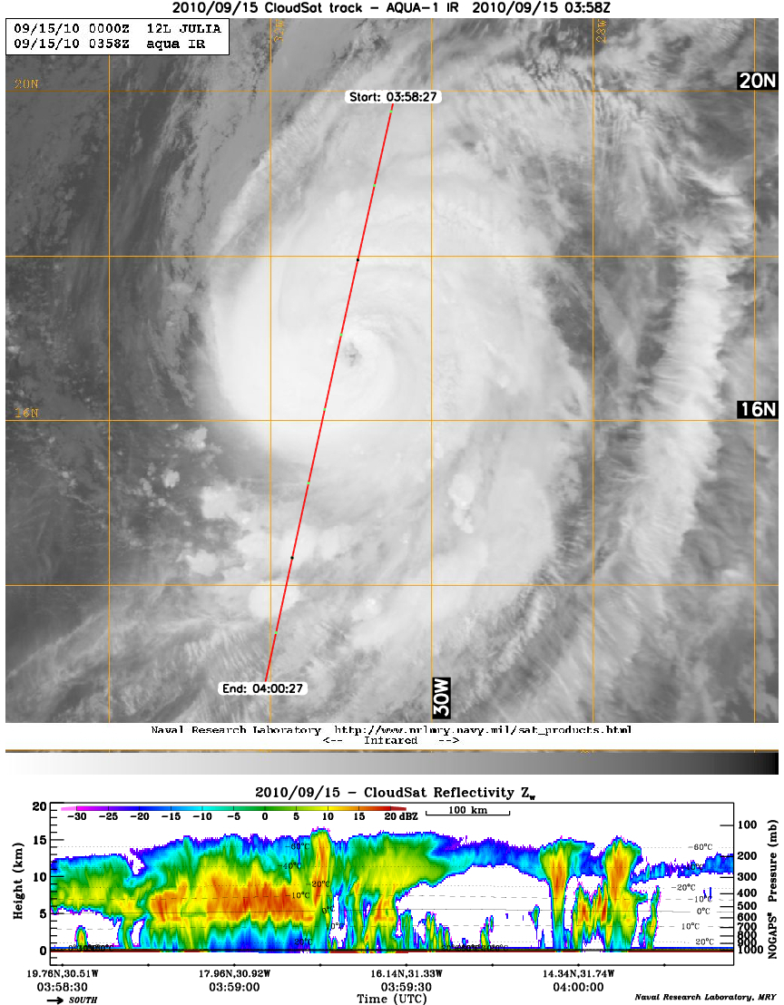
Hurricane Igor
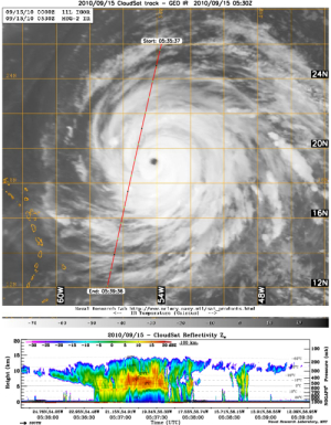
CloudSat made two overpasses of Igor on September 15 and 16, 2010. The first overpass on the 15th, CloudSat intersected the western edge of the system capturing the convection, heavy precipitation and upper level ice. The cirrus canopy stretches across most of the overpass, a deeper convective core is apparent just to the E-SE (10-15 dBz reflectivity reaching 13 km's). CloudSat overpassed to the east of the storm center on September 16 again revealing a well defined, consistent area of convection.
Hurricane Igor Movie animation - 09/15/10 (mp4) - courtesy JPL.
Hurricane Igor Movie animation - 09/16/10 (mp4) - courtesy JPL.
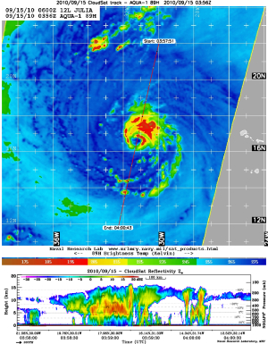
Hurricane Julia
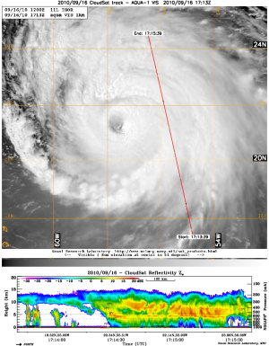
CloudSat overpassed the center of Category 2 Hurricane Julia on the 15th. The eye is difficult to dintinguish from on the IR imagery but the AMSR-E picture (passive microwave imagery) reveals the core center superbly. The AMSR-E imagery captures the convective tower on the northern section of the eyewall extending over 15 km's and sloping outwards, the system's convection is limited to the east due to dry air entrainment and southwesterly shear. The eye is completely overlaid with cirrus and small stratocumulus are visible at the surface.

Hurricane Julia Movie animation - 09/15/10 (mp4) - courtesy JPL.
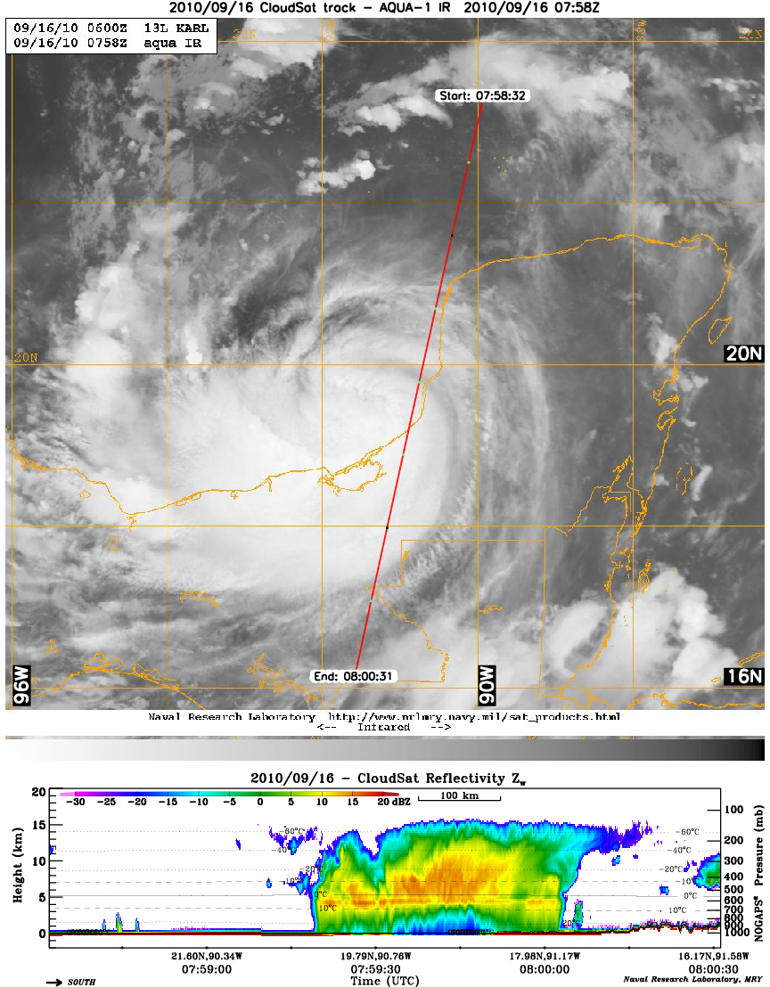
Hurricane Karl
CloudSat overpassed Tropical Storm Karl on September 16th. Moderate to heavy rainfall is evident by the CS's cloud profiling radar (CPR) attenuation (loss of signal) in the lower 4 km's. The bubbly appearance to the cloud top's show the vigorous convection forming as Karl strengthens. This particular overpass of Karl is also part of the GRIP hurricane project, NASA's CloudSat Satellite and GRIP Aircraft Profile Hurricane Karl.

Hurricane Karl Movie animation - 09/16/10 (mp4) - courtesy JPL.
|