|
Education: Remote Sensing
|
 |
|
What is Remote Sensing?
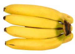
When we measure the length of a banana with a ruler, we make a direct measurement of the banana by coming into contact with the banana, and comparing its length to that of a known standard, such as our ruler. But when we weigh bananas on a scale, we are making an indirect measurement of the weight of the bananas - we are in fact, measuring how far the bananas stretch a spring on the scale, for instance, and from that measurement, deducing the weight of the bananas. These kind of measurements - called "indirect measurements" - still require us to have contact with the objects we measure - you can't use a scale to measure the weight of a bunch of bananas without the bananas, after all.
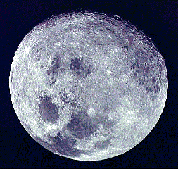
But what if want to measure something that we can't get our hands on? Measuring the weight of a banana is easy - you just put a banana on the scale. What if you wanted to weigh the moon, though? You obviously can't put the moon on a scale - you have to make an indirect measurement of the weight of the moon by observing the effects the moon has on it's environment. An example of this is the tides of Earth's oceans - the side of the earth nearest the moon experiences higher tides. If we know the physics behind why the tides change, we can, from observing the tides, deduce the correct mass of the moon. This is how remote sensing works - we make indirect measurements of properties of objects by observation of the objects rather than by coming into contact with them.
Remote sensing of the atmosphere is generally performed by observation of the interaction of electromagnetic radiation with the objects we wish to observe. There are two ways of doing this - by passively sensing natural radiation levels associated with the matter (called "passive sensing") or by sending a beam of EM radiation towards the object, and observing the scattered return of the beam (called "active sensing".) We'll explain a bit of the difference shortly.
Passive Sensing
Passive remote sensing works in one of three ways:
- We can observe how radiation changes as it passes through matter (such as sunlight passing through a thin cloud). This is called extinction
- We can observe how radiation is emitted by the object of interest (such as the emission of infrared radiation by clouds), or
- We can observe how radiation is scattered by objects (such as a visible satellite image taken from space)
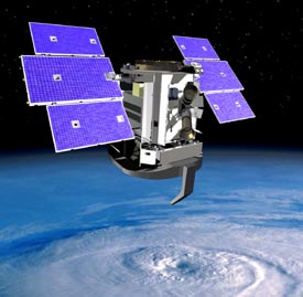
These three methods take advantage of naturally occuring radiation (such as sunlight or infrared radiation emitted by objects) and as such, provide a wealth of information all around us. Our eyes serve as types of passive remote sensing devices - our eyes capture scattered and emitted visible light, which our brains process into images. The GOES series satellites, as well as the AQUA satellite (satellite number 1 in the "A" train) have aboard them many such sensors, and provide a great deal of information about our environment. Most satellites to date use passive-only sensors, although there are a few satellites (such as the TRMM satellite) which use active sensors, which we describe presently.
Active Sensing
Active remote sensing devices work by emitting a signal of some sort, and then by processing the "return" of the emitted signal. This can include looking at how long it took the signal to return, the strength of the returned signal, or changes in the signal, such as frequency shifts (this is what a Doppler radar system looks at) or changes in the orientation of the signal. Bats make extensive use of a natural active remote sensing system: they emit ultrasonic 'squeaks' which bounce off the objects surrounding them - including the moths that the bats eat. By listening to the changes in the return signal, the bat is able to 'see' a moth flying in the dark, and thereby track down the moth to eat. Whales and dolphins use a similar system - called 'sonar' by humans - to augment their other senses.
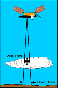
Satellite-based active remote sensing systems include radars (an acronym for RAdio Detection And Ranging) and 'lidars' (an acronym for LIght Detection And Ranging) which work by emitting electromagnetic radiation (either radio waves, in the case of radar, or a laser beam for the lidar system) in the direction of the object to be sampled, and then utilizing a parabolic dish to collect the return (called 'backscattered') radiation for processing by computers. CloudSat carries a cloud radar which emits radio waves at a frequency of 94 GHz and will be able to see fine details of many different types of clouds.
To learn more about Remote Sensing, visit the Canada Centre for Remote Sensing Tutorial.
|


