|
News: Bering Sea Storm
|
 |
|
Bering Sea Storm
CloudSat overpassed an extratropical storm in the Bering Sea on November 8, 2014 at 0133 UTC. This particular system contains the reminants of Super Typhoon Nuri from the West Pacific. CloudSat intersected the storm as the system was moving into the Bering Sea and overpassed the comma shaped center of the storm as it was strengthening, reaching a pressure of 924 mb five hours after this overpass. CloudSat observations reveal the slant-wise clouds directed away from the storm center, indicative of the strong winds associated with system. Cloud top heights are below 9 km and areas of precipitation are observed near the storm center. Mid and high level clouds are observed in areas further from the storm (over land) and areas of cumulus and nimbostratus are found in the center.
The Moderate Resolution Imaging Spectroradiometer (MODIS) on NASA's Aqua satellite captured the infrared (IR) (Figure 1) image taken a few minutes before the CloudSat overpass (Figure 2) denoted by the blue line A->B).
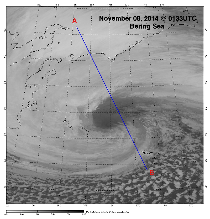 Figure 1. MODIS IR imagery overlaid with CloudSat track (blue) (courtesy NOAA LAADS Web). Figure 1. MODIS IR imagery overlaid with CloudSat track (blue) (courtesy NOAA LAADS Web).
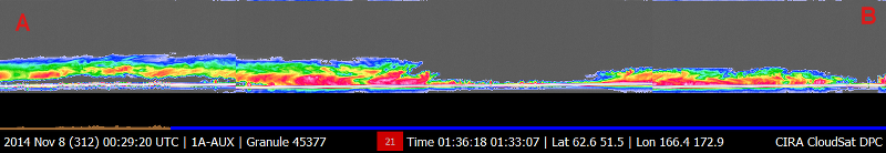 Figure 2. CloudSat overpass track (courtesy CloudSat Data Processing Center). Figure 2. CloudSat overpass track (courtesy CloudSat Data Processing Center).
References:
MODIS imagery, LAADS Web, Retrieved November 10, 2014.
CloudSat imagery, CloudSat DPC, Retrieved November 9, 2014.
Last updated: November 11, 2014 by Natalie D. Tourville
|


