|
News: Tc Yasi
|
 |
|
Tropical Cyclone Yasi
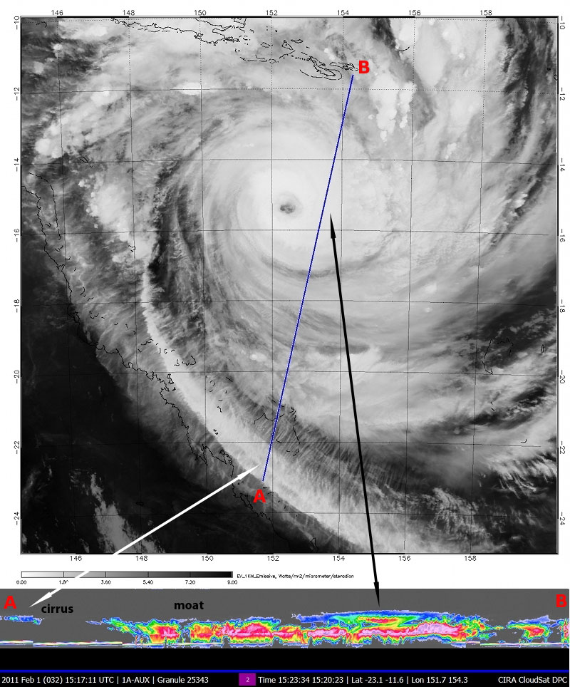
Tropical Cyclone Yasi, a category 4 storm with winds of 155 mph made landfall on the eastern Australian coast on February 3rd, 2011. CloudSat overpassed the storm at 1520 UTC on February 1, 2011, about 32 hours before the storm hit the coast. CloudSat overpassed the eastern section of the storm providing a detailed glimpse of the cirrus (white line), cumulus and cumulonimbus clouds encompassing the system. IR imagery was acquired from MODIS aboard the NASA's Aqua satellite, CloudSat imagery is shown below the image along the blue track line.
Heavier precipitation bands are denoted by absence of radar signal around the inner core region. Gaps in the rainbands outside of the inner core region (called moats) are easily distinguishable by the CloudSat data. The cloud layering structure in the inner core region reveals the upper portion of a much stronger cell (black line) expanding upwards and outwards over smaller cumulus cells.
Tropical Cyclone Yasi is the most intense cyclone to hit Australia since 1918, above normal sea surface temperatures in the southwest Pacific can be attributed to La Nina conditions.
Sources:
|


