|
News: Hurricane Florence
|
 |
|
Hurricane Florence
CloudSat overpassed through the eastern portion of Hurricane Florence on September 11, 2017 @ 1753Z as the storm was moving towards the southeastern coast of the US. The system contained sustained winds of 120 knots (138 mph) with a minimum pressure of 945 mb.
CloudSat overpassed just to the east of the eyewall (Figure 1). The CloudSat overpass (Figure 2) reveals the
The Moderate Resolution Imaging Spectroradiometer (MODIS) on NASA's Aqua satellite captured the infrared (IR) image taken a few minutes before the CloudSat overpass (the blue line on Figure 1). Figure 2 depicts the CloudSat 1B-CPR imagery of the overpass.
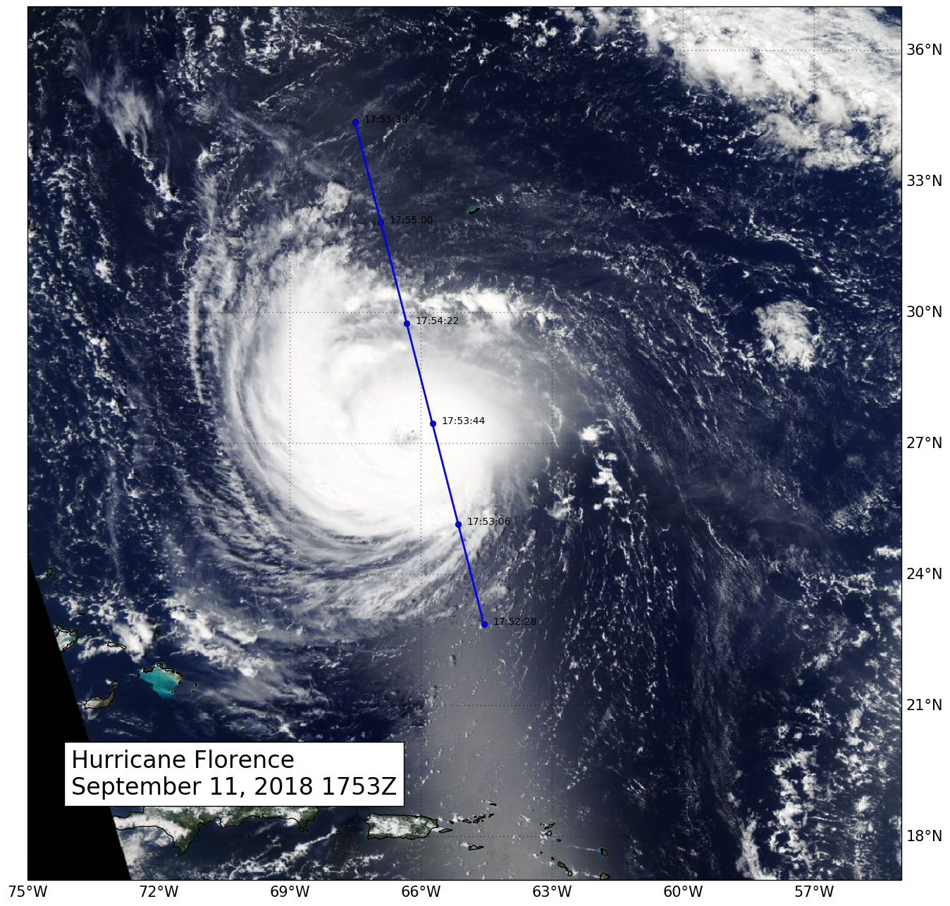
Figure 1. MODIS imagery with CloudSat track and UTC time (blue line) of Hurricane Florence.
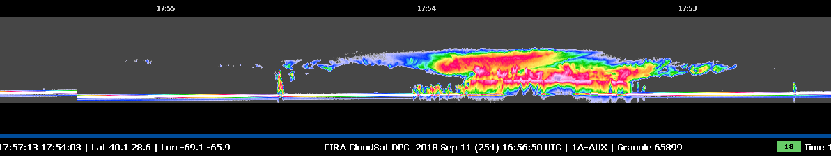
Figure 2. CloudSat 1B-CPR imagery of Hurricane Florence.
References:
MODIS imagery, NASA WorldView, Retrieved September 14, 2018.
CloudSat Data Processing Center, Retrieved September 13, 2018.
RAMMB TC Realtime, Hurricane Florence, Retrieved September 14, 2018.
National Hurricane Center, Hurricane Florence, Retrieved September 19, 2018.
Last Updated: Natalie D. Tourville, September 19, 2018.
|


